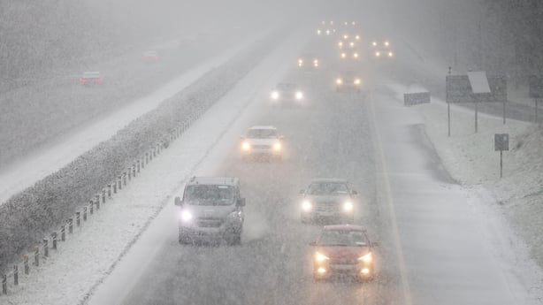
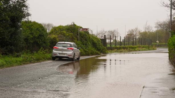
Ireland remains in the grip of a severe cold snap, which has brought icy conditions and travel disruption to parts of the country.
Much of the south and midlands fell under respective Status Orange Snow-Ice, and Snow and Rain warnings over the weekend, which brought falls of snow, while the entire country remains under a Status Yellow Low Temperature warning until Thursday.
Some areas saw heavier snowfalls than others.
Amid calls from some politicians for Met Éireann to have issued a Status Red weather warning given the level of snowfall, Met Éireann senior forecaster Gerry Murphy defended the level of warning issued.
Each weather warning carries with it different levels of advice for people to adhere to, ranging from simply being aware of the impending weather, to people taking active action.
Met Éireann says the core rationale for issuing such warnings is to protect people’s lives and livelihoods, as well as to mitigate damage to property and any disruption to economic activity.
How is each warning categorised? And what does Met Éireann take into account when issuing them?
Status Yellow:
Under Yellow alerts, people are urged to “Be Aware”.
Met Éireann says it is implicit that Status Yellow warnings are for weather conditions that “do not pose a threat to the general population”.
The aim behind them is moreso to notify those who may be exposed to risk because of their location or activity, and allow them take preventative action.
These are usually used for “not unusual weather” or localised danger.
Status Orange:
Under Status Orange alerts, people are urged to “Be Prepared”.
This level of alert is issued by the forecaster for conditions which have the capacity to “impact significantly” on people in affected areas.
Met Éireann says that the issuing of an Orange level alert implies that “all people in the affected areas should prepare themselves in an appropriate way” for the anticipated conditions, and check any activities they may “delay or cancel as appropriate”.

These are used for weather which is infrequent, as well as potentially “dangerous or disruptive weather conditions which may pose a threat to life or property”.
Status Red:
The big one – under Status Red alerts, people are urged to “Take Action”.
Met Éireann says that the issuing of a Status Red alert should, under normal circumstances, be a rare event. They are classed as “very dangerous weather conditions from intense meteorological phenomena”.
Status Red means that those in affected areas should take active actions to protect themselves and their property.
The forecaster says this can be done by moving families out of a danger zone temporarily, staying indoors, or taking other means by which to mitigate the effects of incoming heavy weather conditions.
We need your consent to load this comcast-player contentWe use comcast-player to manage extra content that can set cookies on your device and collect data about your activity. Please review their details and accept them to load the content.Manage Preferences
During a Status Red warning, people are urged to follow instructions and advice given by authorities, and “be prepared for exceptional measures”.
Met Éireann issues weather warnings whenever weather conditions meeting certain detailed thresholds are anticipated within a 48-hour period.
A judgement is then required on the part of the forecaster who must weigh up the possible severity of the weather conditions, as well as the likelihood of their occurrence.
However, Met Éireann says on some occasions such as weekends, and during holiday periods, it may be necessary to issue warnings beyond 48 hours.

What criteria is used to gauge the level of a warning?
Met Éireann says that the numerical criteria below are “strong guidelines”, and that impacts from wind, rain, or snow vary depending on location, recent weather conditions, the state of ground, the time of year as well as the duration of the event.
It adds that: “In any individual weather event, not every location in the warning area may experience the same degree of weather or impacts. When severe weather is expected, weather and impacts at lower levels are also likely to be experienced.”
For Status Red:
For a Status Red Snow-Ice warning, significant snowfalls leading to accumulations of over 10cm in six hours, 15cm or greater in 12 hours, or 30cm or greater in 24 hours, would lead to a warning here.
Under the criteria, minimum air temperatures of -10C (or below) for three consecutive nights or more, a maximum of -2C, as well as the likelihood of a worsening situation with dangerous surfaces would lead to a Low Temperature/Ice warning.
For wind warnings, mean wind speeds in excess of 80km/h and gusts in excess of 130km/h would lead Met Éireann to issue a red level wind warning.
For a Status Red rainfall warning, the anticipated rainfall would have to meet the threshold of over 50mm in six hours, 60mm in 12 hours, or 80mm in 24 hours.
For Status Orange:
For an Orange level Snow-Ice warning, it is similar to that outlined above, however with smaller accumulations of over 3cm rather than 10cm over 6 hours. Minimum air temperatures of -5C would need to be expected over a wide area.
Mean wind speeds of between 65-80km/h and gusts of between 110-130km/h would lead Met Éireann to issue an Orange level wind warning.
For a Status Orange rainfall warning, the anticipated rainfall would have to meet the threshold of 30-50mm in six hours, 40-60mm in 12 hours, or 50-80mm in 24 hours.
For Status Yellow:
For a Status Yellow level Snow-Ice warning, it is similar as outlined above, however with accumulations of less than 3cm over 24 hours.
Mean wind speeds of between 50-65km/h and gusts of between 90-110km/h would lead Met Éireann to issue a Status Yellow wind warning.
For a Status Yellow rainfall warning, the anticipated rainfall would have to meet the threshold of between 20-30mm in six hours, 30-40mm in 12 hours, or 30-50mm in 24 hours.
It adds that the amount of rain can be up to double on windward upper slopes, and impacts can vary.

